
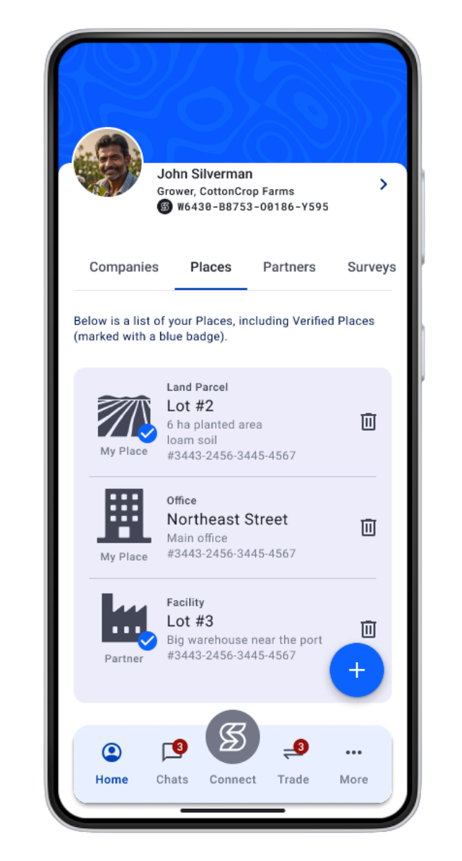
The Sourcery Connect ‘Places’ enables are Partners to register their land parcels, crop areas and facilities and verify each ‘Place’ ensuring that all personal, transactional and impact data is fully private and securely stored in each Partner Data Vault (PDV).
Verified Places.

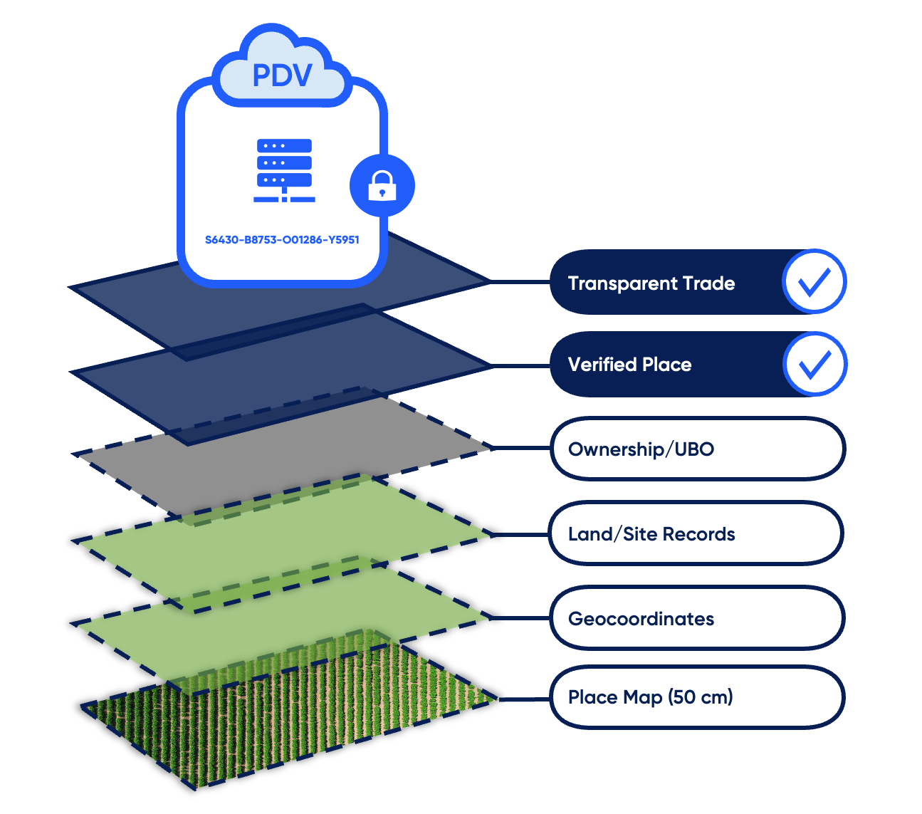
Place Map (50 cm)
A proprietary secure, static mapping system—independent of Google—built specifically for verified trade, origin tracking and data storage.
Geocoordinates
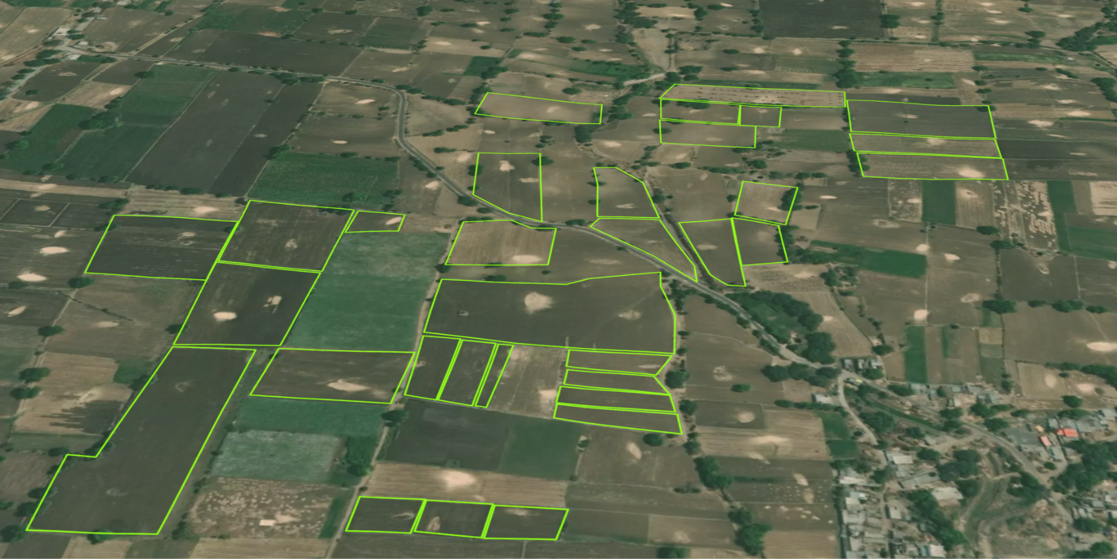
Minimum five-point geocode creates verified site boundaries for each Place, establishing defensible proof of origin and optional geo-fence.
Land/Site Records
Verification of official land records, deeds, permits, and government documentation to validate site legitimacy and use.
Ownership/UBO
Confirmation of beneficial ownership to ensure transparency, accountability, and prevent unauthorised subcontracting.
Once created, each Place receives its own unique digital identity—all Place data is stored privately and securely in your Partner Data Vault (PDV). Learn more.
“A community is the mental and spiritual condition of knowing that the place is shared, and that the people who share the place define and limit the possibilities of each other's lives. “
- Wendell Berry, Author
Proof of Origin.
Sourcery Connect Places supports Partners with owned and operated facilities, land parcels, and sites, as well as Partners who authorise select traders and agents to transact on their behalf.
My Place
A facility, land parcel, or site that you own, lease, or directly operate as part of your business.
My Places are managed and controlled by you and are used to record production, processing, storage, and other on-site activities linked to your transactions
Partner Place
A facility, land parcel, or site owned and operated by a third party, where you are authorised to buy and sell on their behalf. Partner Places enable select traders and agents to execute transactions, manage offers, and record activity for their partners, while ownership and operational control remain fully with the partner.

Place Protection
Place Protection creates a secure geo-fence around each verified site polygon. When enabled by the Place administrator, access to data associated with that Place is restricted to users physically within the defined boundary—ensuring that transaction and impact data are captured and accessed only at the designated site.
Connect uses its own proprietary mapping system, not Google Maps keeping all geocode, address, and polygon data private and fully controlled by the Place owner.
Geo-fenced access: Data can only be captured and viewed within the verified site boundary—critical for desk-based audits and data attribution.
Proof of origin integrity: Ensures transaction and impact data originate from the designated location.
Proprietary mapping system: No reliance on Google Maps, Apple Maps or external third-party map providers who use your data—location data remains 100% private.
Owner-controlled permissions: Place administrators decide who can access data and whether Place Protection is enforced.